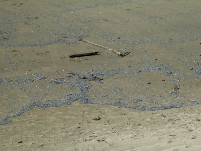
We had 70mph winds lastnight, the power went off for a couple of hours. There are still a record number of warnings up from the National Weather Service.
Currently we still have a High Surf Warning, a High Wind Warning, A Flood Warning, a Gale Warning and the Siuslaw river has now flooded 2 sections of Hwy 126. It's currently closed at Cushman and Tiernan. Note: it is currently flooding during high tides, so check the tide book before traveling.
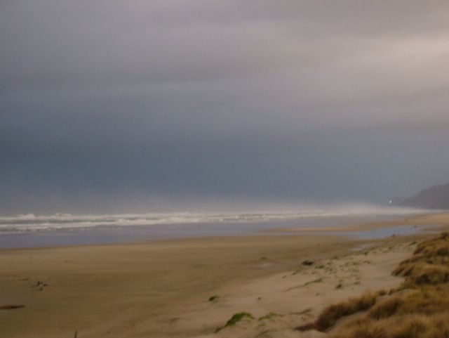
It's certainly making for great storm watching.......
Friday, December 30, 2005
Tuesday, December 27, 2005
Coastal Weather Alerts
This could be a record, 3 alerts from the National Weather Service:
FLOOD WATCH IN EFFECT FROM WEDNESDAY MORNING THROUGH THURSDAY AFTERNOON Issue Time: 1:15PM PST, Tuesday Dec 27, 2005Valid Until: 11:00AM PST, Wednesday Dec 28, 2005
* Prolonged Moderate Rainfall Has Fallen Over Western Oregon During The Past Several Days And Has Resulted In Elevated River And Stream Levels. A Very Moist Southwest Flow Across The Pacific Is Directed Toward Northern California And Western Oregon. The Heaviest Rain Will Be In California And Southern Oregon But Enough Rain Is Likely To Reach West Central Oregon That Flooding Is Possible. As A Result Of This Heavier Rainfall A Number Of Rivers Will Reach Bankfull Stage Beginning Wednesday And Continuing On Thursday. It Is Possible That Some Rivers Could Reach Flood Stage. Rivers Of Greatest Concern Are... The Siuslaw River In Lane County...........
HIGH SURF ADVISORY NOW IN EFFECT UNTIL 4 AM PST THURSDAYIssue Time: 5:57AM PST, Tuesday Dec 27, 2005Valid Until: 2:00PM PST, Tuesday Dec 27, 2005
HIGH SURF ADVISORY NOW IN EFFECT UNTIL 4 AM PST THURSDAYCoastal Hazard Message National Weather Service Portland OR 557 AM PST Tue Dec 27 2005 North Oregon Coast-Central Oregon Coast-South Washington Coast- 557 AM PST Tue Dec 27 2005 ... High Surf Advisory Now In Effect Until 4 AM PST Thursday... The High Surf Advisory Is Now In Effect Until 4 AM PST Thursday. Large Swell From A Very Powerful Pacific Storm System In The Gulf Of Alaska Will Arrive Along The South Washington... North Oregon And Central Oregon Coastline Early This Morning. Seas Of 25 Ft Will Subside To Near 20 Feet By This Evening... But Build Again On Wed To Around 28 Feet. In Addition... Tidal Overflow Will Become A Problem Along The South Washington Coast Beginning Tuesday. The Forecast High Tide At Toke Point Is 9.6 Feet At 920 AM. A Combined Storm Surge And Tidal Anomaly Of Nearly 1.4 Feet Will Result In An Actual Tide Of 11.0 Feet. Past Events Have Shown That Tides Of 11.0 Feet Result In Minor Flooding In And Near The City Of Raymond. Tidal Overflow Will Remain A Problem The Rest Of The Week Due To Increasingly Higher Forecast Tides. Another Storm System Will Impact The Coastline Wednesday... Which Could Result In Actual High Tides Approaching 11.5 Feet. The Forecast Highest Tides Are: Wednesday 10.1 Feet At 1004 AM Thursday 10.5 Feet At 1050 AM Friday 10.8 Feet At 1137 AM A High Surf Advisory Means That High Surf Will Affect Beaches In The Advisory Area... Producing Rip Currents And Localized Beach Erosion.
High wind watch in effect from late tonight through Wednesday afternoon.
The Storm Watching has been great don't forget to check the webcam.
Monday, December 26, 2005
Tsunami Siren and Test
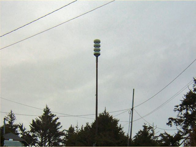
The New Tsunami Siren for the Heceta Beach Area. Located on 3rd Ave it seems to Alert the Neighborhood quite well, according to my neighbors. However it was reported that if you were inside running some kind of appliance vaccum cleaner or hair dryer you couldn't hear it. The City will be working on this.....
From the City's Website:Emergency Preparedness Officials will be conducting a TEST of the newly installed tsunami sirens on the last Friday of each month at 11:00 a.m. The next test is scheduled for Friday January 27th at 11:00 am. The test will not exceed 5 minutes and no action is required from the community. The test tone is one long steady sound. Please do not call 9-1-1. Should this be a real time event where an evacuation is ordered, the sirens would be activated and you would hear a wail tone. The wail tone will vary from high to low warble and run continuously for as long as needed. Once an “all clear” is ordered, the Winchester Chimes will sound for one minute, and then there will be a two minute grace period. This process will run a total of five sets.
Friday, October 14, 2005
High Wind Warning
Our first High Wind Warning of the year:
ALERT 1 - Non Precipitation Advisory
HIGH WIND WARNING IN EFFECT FROM 9 PM THIS EVENING TO 5 AM PDT SATURDAY FOR THE COASTAL HEADLANDS AND NEAR SHORE COMMUNITIES OF THE NORTH AND CENTRAL OREGON COAST
Issue Time: 7:57AM PDT, Friday Oct 14, 2005
Valid Until: 4:00PM PDT, Friday Oct 14, 2005
Back to summary
HIGH WIND WARNING IN EFFECT FROM 9 PM THIS EVENING TO 5 AM PDT SATURDAY FOR THE COASTAL HEADLANDS AND NEAR SHORE COMMUNITIES OF THE NORTH AND CENTRAL OREGON COAST
UNTIL 4:00PM PDT
Urgent - Weather Message National Weather Service Portland OR 757 AM PDT Fri Oct 14 2005
North Oregon Coast-Central Oregon Coast- Including The Cities Of... Astoria... Cannon Beach... Tillamook... Lincoln City... Newport... Florence 757 AM PDT Fri Oct 14 2005
... High Wind Warning In Effect From 9 PM This Evening To 5 AM PDT Saturday For The Coastal Headlands And Near Shore Communities Of The North And Central Oregon Coast...
The National Weather Service In Portland Has Issued A High Wind Warning... Which Is In Effect From 9 PM This Evening To 5 AM PDT Saturday.
An Approaching Pacific Frontal System And Low Pressure Area Will Bring Strong Winds To The Coastal Headlands And Near Shore Communities Of The North And Central Oregon Coast Beginning This Evening. South Winds 35 Mph With Gusts 60 Mph Are Expected Along The North And Central Oregon Coast Headlands And Near Shore Communities From 9 PM Tonight To Around 5 AM Saturday.
Persons Planning To Drive High Profile Vehicles In Those Areas Should Be Prepared For Strong Buffeting Wind Gusts.
A High Wind Warning Means A Hazardous High Wind Event Is Expected OR Occurring. Sustained Wind Speeds Of At Least 40 Mph OR Gusts Of 58 Mph OR More Can Lead To Property Damage.
Monday, October 03, 2005
Tiger Striped Slug
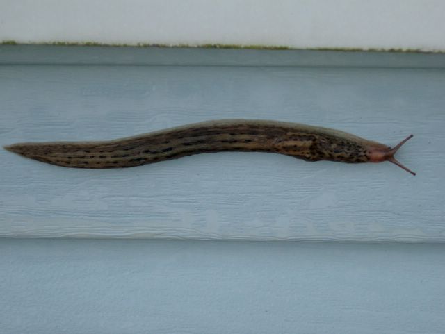
A rather Amazing 6 inch long tiger striped slug. Found crawling up the exterior of Whales Watch
Leslie
Wednesday, September 28, 2005

Saturday, August 27, 2005
1944 Stearman
Here's a cool new thing in Florence. You can take rides along the coast in this historical aircraft, very cool!. I haven't done it yet, but it's now on my list of things to do.
Here are the photos, I took earlier this week.
http://whaleswatch.com/images/stearman/index.htm
and here's the site to book your adventure:
http://www.aerolegends.com/
Here are the photos, I took earlier this week.
http://whaleswatch.com/images/stearman/index.htm
and here's the site to book your adventure:
http://www.aerolegends.com/
Tuesday, August 16, 2005
Fog
Fog - For the last 10 days anyone checking my webcam has probably seen a fuzzy white blur. We've had occasional sunny spots, and I've seen the ocean a few times. But due to the hot temperatures inland, Heceta Beach has predominantly been sitting in the fog. However 4 blocks inland has been sunny, such is life on the Oregon coast in the summer. Just wanted everyone to know that the webcam isn't malfunctioning.
Thursday, August 04, 2005
Tides August 4-18
Day        High      Tide  Height   Sunrise    Moon  Time      % Moon
           /Low      Time    Feet    Sunset                    Visible

Th   4      Low   6:51 AM    -0.8   6:08 AM    Rise  5:22 AM      1
     4     High   1:26 PM     5.7   8:36 PM     Set  8:57 PM
     4      Low   6:40 PM     2.7

F    5     High  12:23 AM     7.1   6:09 AM    Rise  6:27 AM      0
     5      Low   7:24 AM    -0.8   8:35 PM     Set  9:20 PM
     5     High   1:55 PM     5.9
     5      Low   7:17 PM     2.5

Sa   6     High   1:00 AM     7.0   6:11 AM    Rise  7:32 AM      0
     6      Low   7:55 AM    -0.7   8:34 PM     Set  9:40 PM
     6     High   2:23 PM     6.0
     6      Low   7:54 PM     2.2

Su   7     High   1:37 AM     6.8   6:12 AM    Rise  8:36 AM      2
     7      Low   8:24 AM    -0.5   8:32 PM     Set  9:58 PM
     7     High   2:51 PM     6.0
     7      Low   8:32 PM     2.0

M    8     High   2:13 AM     6.5   6:13 AM    Rise  9:40 AM      7
     8      Low   8:52 AM    -0.2   8:31 PM     Set 10:14 PM
     8     High   3:18 PM     6.2
     8      Low   9:11 PM     1.8

Tu   9     High   2:53 AM     6.1   6:14 AM    Rise 10:44 AM      12
     9      Low   9:20 AM     0.4   8:29 PM     Set 10:31 PM
     9     High   3:46 PM     6.3
     9      Low   9:54 PM     1.6

W   10     High   3:37 AM     5.7   6:15 AM    Rise 11:49 AM      19
    10      Low   9:49 AM     1.0   8:28 PM     Set 10:49 PM
    10     High   4:15 PM     6.5
    10      Low  10:42 PM     1.4

Th  11     High   4:28 AM     5.2   6:16 AM    Rise 12:58 PM      28
    11      Low  10:20 AM     1.5   8:27 PM     Set 11:11 PM
    11     High   4:48 PM     6.6
    11      Low  11:37 PM     1.2

F   12     High   5:33 AM     4.7   6:17 AM    Rise  2:10 PM      37
    12      Low  10:57 AM     2.2   8:25 PM     Set 11:37 PM
    12     High   5:27 PM     6.7

Sa  13      Low  12:42 AM     0.9   6:18 AM    Rise  3:25 PM      48
    13     High   6:55 AM     4.4   8:24 PM
    13      Low  11:45 AM     2.9
    13     High   6:18 PM     6.8

Su  14      Low   1:53 AM     0.5   6:20 AM     Set 12:11 AM      59
    14     High   8:29 AM     4.4   8:22 PM    Rise  4:40 PM
    14      Low  12:54 PM     3.4
    14     High   7:21 PM     7.0

M   15      Low   3:03 AM    -0.1   6:21 AM     Set 12:57 AM      69
    15     High   9:52 AM     4.7   8:20 PM    Rise  5:51 PM
    15      Low   2:20 PM     3.6
    15     High   8:30 PM     7.3

Tu  16      Low   4:06 AM    -0.7   6:22 AM     Set  1:57 AM      79
    16     High  10:54 AM     5.2   8:19 PM    Rise  6:50 PM
    16      Low   3:39 PM     3.4
    16     High   9:37 PM     7.6

W   17      Low   5:01 AM    -1.2   6:23 AM     Set  3:12 AM      88
    17     High  11:42 AM     5.7   8:17 PM    Rise  7:37 PM
    17      Low   4:45 PM     2.9
    17     High  10:39 PM     8.0
Tuesday, July 12, 2005
Tides for Suislaw River Entrance - 7/12 - 7/25
Day        High      Tide  Height   Sunrise    Moon  Time      % Moon
           /Low      Time    Feet    Sunset                    Visible

Tu  12     High   3:54 AM     5.6   5:45 AM    Rise 11:47 AM      24
    12      Low  10:34 AM     0.4   8:59 PM
    12     High   5:16 PM     6.0
    12      Low  11:22 PM     2.3

W   13     High   4:48 AM     5.1   5:46 AM     Set 12:08 AM      33
    13      Low  11:08 AM     1.0   8:58 PM    Rise 12:52 PM
    13     High   5:51 PM     6.2

Th  14      Low  12:22 AM     1.9   5:47 AM     Set 12:25 AM      42
    14     High   5:54 AM     4.6   8:57 PM    Rise  1:59 PM
    14      Low  11:47 AM     1.6
    14     High   6:29 PM     6.4

F   15      Low   1:26 AM     1.3   5:48 AM     Set 12:45 AM      53
    15     High   7:15 AM     4.3   8:57 PM    Rise  3:10 PM
    15      Low  12:34 PM     2.2
    15     High   7:13 PM     6.7

Sa  16      Low   2:30 AM     0.8   5:49 AM     Set  1:08 AM      63
    16     High   8:42 AM     4.3   8:56 PM    Rise  4:26 PM
    16      Low   1:33 PM     2.8
    16     High   8:02 PM     7.1

Su  17      Low   3:31 AM     0.0   5:50 AM     Set  1:39 AM      73
    17     High  10:02 AM     4.6   8:55 PM    Rise  5:44 PM
    17      Low   2:40 PM     3.2
    17     High   8:55 PM     7.4

M   18      Low   4:27 AM    -0.8   5:51 AM     Set  2:19 AM      82
    18     High  11:08 AM     5.0   8:55 PM    Rise  7:01 PM
    18      Low   3:48 PM     3.3
    18     High   9:51 PM     7.8

Tu  19      Low   5:19 AM    -1.4   5:52 AM     Set  3:13 AM      90
    19     High  12:02 PM     5.5   8:54 PM    Rise  8:08 PM
    19      Low   4:51 PM     3.1
    19     High  10:47 PM     8.2

W   20      Low   6:09 AM    -2.0   5:53 AM     Set  4:23 AM      96
    20     High  12:50 PM     5.8   8:53 PM    Rise  9:03 PM
    20      Low   5:48 PM     2.8
    20     High  11:41 PM     8.4

Th  21      Low   6:56 AM    -2.3   5:54 AM     Set  5:44 AM      99
    21     High   1:34 PM     6.1   8:52 PM    Rise  9:46 PM
    21      Low   6:43 PM     2.4

F   22     High  12:35 AM     8.4   5:55 AM     Set  7:10 AM      99
    22      Low   7:42 AM    -2.4   8:51 PM    Rise 10:18 PM
    22     High   2:17 PM     6.4
    22      Low   7:38 PM     2.0

Sa  23     High   1:28 AM     8.3   5:56 AM     Set  8:35 AM      96
    23      Low   8:27 AM    -2.2   8:50 PM    Rise 10:44 PM
    23     High   2:59 PM     6.7
    23      Low   8:33 PM     1.6

Su  24     High   2:21 AM     7.8   5:57 AM     Set  9:57 AM      90
    24      Low   9:10 AM    -1.6   8:49 PM    Rise 11:06 PM
    24     High   3:41 PM     6.9
    24      Low   9:30 PM     1.3

M   25     High   3:17 AM     7.1   5:58 AM     Set 11:14 AM      82
    25      Low   9:53 AM    -1.0   8:48 PM    Rise 11:26 PM
    25     High   4:23 PM     7.1
    25      Low  10:30 PM     1.2
Monday, July 04, 2005
Coast Guard suspends search for missing teen lost in surf
From a Coast Guard Press Release
Florence, OR - The Coast Guard suspended the search for a 15-year-old boy who was last seen in the surf Tuesday, north of the Siuslaw River Jetty near Harbor Vista Park in Florence, Ore.
The search for Ian Foster, which began at about 2 p.m., Tuesday was called off at 8 p.m.
Two HH-65 Dolphin helicopters from Air Station North Bend, Ore., two 47-foot Motor Life Boats and a shore patrol from Coast Guard Station Siuslaw River, Ore., responded. Local fire department crews, a fire department dive team and emergency medical technicians also searched for the boy.
The Coast Guard received a report from local 911 at 1:35 p.m., Tuesday that Foster was struggling in the surf.
One of the 47-foot Motor Life Boats reported seeing Foster struggling in the water in the surf zone. After the first sighting, Coast Guard crews lost sight of the boy.
The helicopter and boat crews thoroughly searched a three-and-a-half by two-and-a-half mile area around the Siuslaw River Jetty but found no sign of Foster.
The Coast Guard would like to remind beach goers that wading or swimming along coastal beaches can be hazardous. Swift currents and unpredictable rip tides can grab swimmers pulling them further offshore. Surf zones often have debris, such as logs that weigh several tons, that can injure swimmers.
Editors Note: The Lane County Sherrifs Office continues to patrol Heceta Beach several times a day, in hopes of recoving Ian's body.
Tuesday, June 28, 2005
Rescue......
I came home this evening to a coast guard helicopter circling, and a Coast guard boat going up and down the coast quite close in, I assumed like so many nights that they were out doing a drill. Then I saw all the emergency vehicles driving up and down the beach and realized that this was no dril, it was a real rescue situation. My neighbors called me to ask if I'd heard what was going on and I called a friend who's husband is a local volunteer firefighter and found that someone had lost a child to the surf. After more than 4 hours I realized that it probably wasn't a rescue. The coast guard continued the search for 4 1/2 hours and our local volunteers are still out riding up and down the beach slowly scanning the surf with binoculars.
I know I'll hear the whole story tomorrow on the news and in the papers, but it's heart wrenching to watch and to know the suffering the family is going through. This is the first time in my almost 11 years at Heceta Beach that I've ever seen something like this. But it's summer and the beaches are packed with people. I watched 6 unattended children under the age of 10 play in the surf while the full search was going on... The ocean while somewhat tame in the summer, is always really dangerous. Just 2 days ago I had warned my current guests and their young daughter about it.
Thanks to our volunteers who go out for long hours to help in these horrible situations. The sun is about an hour from setting and it appears that they are going to stay out till it gets dark. My thoughts are with the family of the lost child!!!
Thursday, June 23, 2005
Tides for Siuslaw River Entrance 6/23 - 7/6
Tides for Siuslaw River Entrance starting
with June 23, 2005.
Day        High      Tide  Height   Sunrise    Moon  Time      % Moon
          /Low      Time    Feet    Sunset                    Visible

Th  23     High  12:42 AM     8.4   5:34 AM     Set  6:51 AM      99
   23      Low   7:59 AM    -2.4   9:03 PM    Rise 11:14 PM
   23     High   2:41 PM     6.1
   23      Low   7:45 PM     2.8

F   24     High   1:33 AM     8.3   5:35 AM     Set  8:14 AM      95
   24      Low   8:46 AM    -2.3   9:03 PM    Rise 11:51 PM
   24     High   3:29 PM     6.2
   24      Low   8:42 PM     2.6

Sa  25     High   2:27 AM     7.9   5:35 AM     Set  9:38 AM      88
   25      Low   9:34 AM    -2.0   9:03 PM
   25     High   4:17 PM     6.3
   25      Low   9:43 PM     2.4

Su  26     High   3:24 AM     7.2   5:35 AM    Rise 12:19 AM      80
   26      Low  10:22 AM    -1.4   9:04 PM     Set 10:59 AM
   26     High   5:05 PM     6.5
   26      Low  10:49 PM     2.1

M   27     High   4:26 AM     6.4   5:36 AM    Rise 12:42 AM      70
   27      Low  11:11 AM    -0.7   9:03 PM     Set 12:15 PM
   27     High   5:53 PM     6.7

Tu  28      Low  12:00 AM     1.8   5:36 AM    Rise  1:02 AM      59
   28     High   5:35 AM     5.7   9:03 PM     Set  1:29 PM
   28      Low  12:01 PM     0.2
   28     High   6:41 PM     6.9

W   29      Low   1:13 AM     1.3   5:37 AM    Rise  1:22 AM      48
   29     High   6:53 AM     5.0   9:03 PM     Set  2:41 PM
   29      Low  12:53 PM     1.1
   29     High   7:29 PM     7.1

Th  30      Low   2:24 AM     0.8   5:37 AM    Rise  1:42 AM      37
   30     High   8:17 AM     4.7   9:03 PM     Set  3:52 PM
   30      Low   1:48 PM     1.8
   30     High   8:17 PM     7.2

F    1      Low   3:27 AM     0.1   5:38 AM    Rise  2:04 AM      27
    1     High   9:40 AM     4.7   9:03 PM     Set  5:02 PM
    1      Low   2:46 PM     2.5
    1     High   9:03 PM     7.3

Sa   2      Low   4:22 AM    -0.4   5:38 AM    Rise  2:29 AM      18
    2     High  10:53 AM     4.9   9:03 PM     Set  6:12 PM
    2      Low   3:44 PM     2.9
    2     High   9:49 PM     7.4

Su   3      Low   5:10 AM    -0.8   5:39 AM    Rise  3:01 AM      11
    3     High  11:52 AM     5.2   9:03 PM     Set  7:18 PM
    3      Low   4:38 PM     3.2
    3     High  10:33 PM     7.4

M    4      Low   5:54 AM    -1.0   5:39 AM    Rise  3:40 AM      6
    4     High  12:39 PM     5.4   9:02 PM     Set  8:19 PM
    4      Low   5:28 PM     3.3
    4     High  11:16 PM     7.4

Tu   5      Low   6:34 AM    -1.1   5:40 AM    Rise  4:28 AM      2
    5     High   1:19 PM     5.6   9:02 PM     Set  9:10 PM
    5      Low   6:13 PM     3.2
    5     High  11:57 PM     7.3

W    6      Low   7:11 AM    -1.2   5:41 AM    Rise  5:24 AM      0
    6     High   1:55 PM     5.7   9:02 PM     Set  9:53 PM
    6      Low   6:54 PM     3.1
Tuesday, June 21, 2005
First large-scale tsunami warning since 1980
Well a bunch has gone on since the cancelled Tsunami warning. Our town said they messed up as a whole... Luckily it wasn't for real. Emergency lines were inundated with non-emergency calls, they never engaged the reverse 911 call system, so those of us waiting for that were idiots! City Hall, the Police, The Fire Department, and our radio station didn't have any lines open to call each other. All of this is going to be changed, along with going back to the old fashioned air raid sirens...
" FLORENCE - Oregon emergency managers spent Wednesday analyzing their response to the previous night's tsunami warning, looking for flaws in their plans.
"In the coastal community of Florence, there were no evacuations or warning sirens. Instead, people parked their cars at the peak of coastal cliffs between Florence and Yachats to watch the water, The Register-Guard of Eugene reported. "Read the story from KATU.
Our neighborhood, which includes the 4 houses, and 4 vacation rentals, have developed a plan for the next one, which includes the vacationers who won't be expecting it. We all agreed we should have left the first time, standing around discussing it, while waiting for the official call was a STUPID idea.
" FLORENCE - Oregon emergency managers spent Wednesday analyzing their response to the previous night's tsunami warning, looking for flaws in their plans.
Two problems were immediately clear: Conflicting bulletins confused some emergency managers - one said there was no warning in effect, the other issued an alert. And coastal communities reacted to the warning differently. Some evacuated their residents. Others didn't, waiting for word of an actual tsunami from the National Weather Service.
The thing to do, said state earthquake and tsunami program coordinator Jay Wilson, was to clear out low-lying areas as soon as the warning came.
"If we waited for how long it took scientists to basically scale down the size of the earthquake, it would have been too late," Wilson said.
In fact, if a tsunami had been generated from Tuesday's quake, it would have hit shore before it struck buoys in the ocean that scientists rely on to detect tsunamis, said geophysicist Bruce Turner, directing the West Coast and Alaska Tsunami Warning Center, which issued the alert after a magnitude 7 earthquake struck off the coast of Northern California on Tuesday night.
"Travel time to the buoys was about 48 minutes," Turner said of the "what if" estimates from last night's readings. "Travel time to the coast was 30 minutes. The buoys didn't help us as much as we would have liked."
But Florence officials told callers to stand by and listen for more information on the radio, Siuslaw Valley Fire Protection District Chief John Buchanan said. He consulted with the Florence city manager and port manager and decided to wait." Read about this in the Register Guard."In the coastal community of Florence, there were no evacuations or warning sirens. Instead, people parked their cars at the peak of coastal cliffs between Florence and Yachats to watch the water, The Register-Guard of Eugene reported. "Read the story from KATU.
Our neighborhood, which includes the 4 houses, and 4 vacation rentals, have developed a plan for the next one, which includes the vacationers who won't be expecting it. We all agreed we should have left the first time, standing around discussing it, while waiting for the official call was a STUPID idea.
Tuesday, June 14, 2005
Tsunami Warning Cancelled for Florence Oregon
After living here for 11 years, I experienced my first serious Tsunami warning this evening. While I didn't panic, I also didn't hit the road for higher ground immediately like I probably should have. My first warning came when a relative from the Rogue Valley called. It was a good thing they called as I was sitting in front of my computer totally unaware of it. I went to the Tsunami warning website, and at that point I had 20 minutes to leave based on their predictions. I woke up my husband, put on jeans and sensible shoes, leashed the dog, tried to call my neighbors and then ran to their house, as I knew she was online.
So the four of us stared at NW Cable News trying to figure out whether we should leave or not. All, this while people kept walking by on the beach, many people were unaware it had been issued. Once I received that initial call, my phone and cell phone rang off the hook, with friends who were in safe locales... warning me (all of them know my TV is never on).
We have an emergency information phone system that's supposed to call everyone in a tsunami emergency but my phone never rang and I don't know if our town ever set it in action... They had downgraded it to a Bulletin by the time the initial wave was supposed to hit, 8:49. Of course had a wave been coming we would have all been done for. I learned that a bulletin meant that low lying area's were still threatened but a large damaging wave was unexpected. We then proceeded to watch experts, until they announced another hour later that the whole thing had been cancelled it wasn't the type of quake that generated a tsunami.
This whole thing has made me realize that a bit more of a plan would have made me feel better. I now have a folder of favorites, for Real Time information on Tsunami's so there won't be any searching for it, and I know where to navigate on each site, to get what I need. Interesting experience that makes you realize what you need to do, so you'll be prepared for the real thing. I'll be doing some more planning!!
Tuesday, June 07, 2005
Florence Tides June 7-14
Tides for Suislaw River Entrance
starting with June 7, 2005.
Day        High      Tide  Height   Sunrise    Moon  Time      % Moon
           /Low      Time    Feet    Sunset                    Visible

Tu   7     High  12:15 AM     7.6   5:34 AM    Rise  5:43 AM      0
     7      Low   7:27 AM    -1.3   8:57 PM     Set 10:25 PM
     7     High   2:10 PM     5.8
     7      Low   7:10 PM     3.2

W    8     High  12:51 AM     7.4   5:34 AM    Rise  6:34 AM      1
     8      Low   8:05 AM    -1.2   8:58 PM     Set 11:14 PM
     8     High   2:50 PM     5.8
     8      Low   7:50 PM     3.3

Th   9     High   1:28 AM     7.2   5:34 AM    Rise  7:32 AM      3
     9      Low   8:43 AM    -1.0   8:58 PM     Set 11:53 PM
     9     High   3:30 PM     5.7
     9      Low   8:31 PM     3.3

F   10     High   2:06 AM     6.8   5:33 AM    Rise  8:36 AM      8
    10      Low   9:22 AM    -0.8   8:59 PM
    10     High   4:11 PM     5.6
    10      Low   9:15 PM     3.4

Sa  11     High   2:46 AM     6.5   5:33 AM     Set 12:24 AM      14
    11      Low  10:01 AM    -0.5   8:59 PM    Rise  9:40 AM
    11     High   4:53 PM     5.5
    11      Low  10:04 PM     3.3

Su  12     High   3:30 AM     6.0   5:33 AM     Set 12:49 AM      21
    12      Low  10:41 AM    -0.1   9:00 PM    Rise 10:45 AM
    12     High   5:35 PM     5.5
    12      Low  11:01 PM     3.2

M   13     High   4:19 AM     5.6   5:33 AM     Set  1:10 AM      30
    13      Low  11:22 AM     0.3   9:00 PM    Rise 11:49 AM
    13     High   6:17 PM     5.7

Tu  14      Low  12:05 AM     3.0   5:33 AM     Set  1:29 AM      39
    14     High   5:19 AM     5.1   9:01 PM    Rise 12:53 PM
    14      Low  12:05 PM     0.8
    14     High   6:57 PM     5.9

W   15      Low   1:13 AM     2.5   5:33 AM     Set  1:46 AM      48
    15     High   6:30 AM     4.7   9:01 PM    Rise  1:58 PM
    15      Low  12:50 PM     1.2
    15     High   7:37 PM     6.1

Th  16      Low   2:16 AM     1.9   5:33 AM     Set  2:03 AM      58
    16     High   7:48 AM     4.5   9:02 PM    Rise  3:05 PM
    16      Low   1:39 PM     1.7
    16     High   8:15 PM     6.5

F   17      Low   3:13 AM     1.1   5:33 AM     Set  2:22 AM      68
    17     High   9:06 AM     4.6   9:02 PM    Rise  4:16 PM
    17      Low   2:30 PM     2.2
    17     High   8:55 PM     6.9

Sa  18      Low   4:03 AM     0.2   5:33 AM     Set  2:44 AM      77
    18     High  10:17 AM     4.8   9:02 PM    Rise  5:32 PM
    18      Low   3:24 PM     2.6
    18     High   9:36 PM     7.4

Su  19      Low   4:51 AM    -0.6   5:33 AM     Set  3:11 AM      86
    19     High  11:19 AM     5.2   9:03 PM    Rise  6:51 PM
    19      Low   4:17 PM     2.8
    19     High  10:19 PM     7.8

M   20      Low   5:38 AM    -1.3   5:33 AM     Set  3:46 AM      93
    20     High  12:14 PM     5.5   9:03 PM    Rise  8:11 PM
    20      Low   5:09 PM     3.0
    20     High  11:05 PM     8.2
Thursday, May 26, 2005
Tides May 26 - Saturday June 4
Day        High      Tide  Height   Sunrise    Moon  Time      % Moon
/Low Time Feet Sunset Visible

Th 26 High 1:41 AM 8.2 5:40 AM Set 7:56 AM 93
26 Low 8:59 AM -2.0 8:48 PM
26 High 3:45 PM 6.0
26 Low 8:46 PM 3.1

F 27 High 2:32 AM 7.9 5:39 AM Rise 12:38 AM 87
27 Low 9:50 AM -1.7 8:48 PM Set 9:13 AM
27 High 4:40 PM 6.0
27 Low 9:46 PM 3.2

Sa 28 High 3:28 AM 7.3 5:39 AM Rise 1:19 AM 78
28 Low 10:44 AM -1.3 8:49 PM Set 10:34 AM
28 High 5:37 PM 6.0
28 Low 10:56 PM 3.1

Su 29 High 4:32 AM 6.7 5:38 AM Rise 1:51 AM 67
29 Low 11:41 AM -0.8 8:50 PM Set 11:54 AM
29 High 6:34 PM 6.1

M 30 Low 12:15 AM 2.8 5:37 AM Rise 2:16 AM 56
30 High 5:45 AM 6.0 8:51 PM Set 1:11 PM
30 Low 12:38 PM -0.2
30 High 7:27 PM 6.4

Tu 31 Low 1:35 AM 2.2 5:37 AM Rise 2:37 AM 45
31 High 7:06 AM 5.5 8:52 PM Set 2:25 PM
31 Low 1:36 PM 0.4
31 High 8:17 PM 6.8

W 1 Low 2:47 AM 1.3 5:36 AM Rise 2:56 AM 34
1 High 8:28 AM 5.2 8:53 PM Set 3:37 PM
1 Low 2:31 PM 1.0
1 High 9:02 PM 7.1

Th 2 Low 3:49 AM 0.6 5:36 AM Rise 3:15 AM 24
2 High 9:45 AM 5.2 8:54 PM Set 4:48 PM
2 Low 3:24 PM 1.5
2 High 9:44 PM 7.5

F 3 Low 4:41 AM -0.2 5:35 AM Rise 3:36 AM 15
3 High 10:53 AM 5.3 8:54 PM Set 6:00 PM
3 Low 4:14 PM 2.0
3 High 10:23 PM 7.7

Sa 4 Low 5:27 AM -0.8 5:35 AM Rise 3:59 AM 8
4 High 11:51 AM 5.5 8:55 PM Set 7:11 PM
4 Low 5:01 PM 2.5
4 High 11:01 PM 7.7
Sunday, May 22, 2005
1967 Imperial Sedan wins Best Daily Driver

My 1967 Imperial Sedan, won "Best Daily Driver" at the 13th annual, Rhody Days Show and Shine, in Florence Oregon. To me this is a much nicer award to win, then the ones given for the cars brought in on trailers. Everyone has their own opinions, but I have my cars to drive, not as display art.
The weather for our Rhododendron Festival was mostly nice. Friday was great, Saturday it rained in the late afternoon (while this picture was being taken) but was nice again by 8:30pm, Sunday we had a few sprinkles, but then the sun came out and it was fantastic. So overall the weather wasn't bad.
Tuesday, May 17, 2005
98th Rhododendron Festival
The Rhododendron Festival is a huge event for Florence, and a busy time here at Whales Watch. I'm guessing I won't be posting much between now and then, as I have a lot to get organized before our group arrives.
We host a gathering of theImperial Club every year. Below I picked a shot from each year of our last 5 years of Imperial meets. The whole group parked at Whales Watch the first year, 1964 Imperial parked north of Florence, part of our group parked at the light keepers house, my 1967 Imperial Sedan, parked at the view point for the lighthouse, and last year our cars parked at the rainy car show. It was the only year it rained on us and I'm hoping this years weather is nice. The 7 day forecast is calling for partly cloudy on Friday, partly sunny on Saturday. Sounds perfect!


Thursday, May 12, 2005
Webcam & Tides for May 12 - May 18, 2005
The webcam is pretty stable now, it took a little bit of messing with it, but I can now say it functions more often than not, you can always click on the sunset Icon in the left hand column, or find it here.
Day        High      Tide  Height   Sunrise    Moon  Time      % Moon
           /Low      Time    Feet    Sunset                    Visible

Th  12     High   2:29 AM     7.0   5:53 AM     Set 12:33 AM      12
    12      Low   9:45 AM    -0.5   8:33 PM    Rise  8:43 AM
    12     High   4:34 PM     5.5
    12      Low   9:33 PM     3.6

F   13     High   3:09 AM     6.5   5:52 AM     Set  1:18 AM      19
    13      Low  10:31 AM    -0.1   8:34 PM    Rise  9:43 AM
    13     High   5:27 PM     5.3
    13      Low  10:25 PM     3.6

Sa  14     High   3:56 AM     6.1   5:51 AM     Set  1:54 AM      27
    14      Low  11:20 AM     0.3   8:35 PM    Rise 10:47 AM
    14     High   6:22 PM     5.3
    14      Low  11:31 PM     3.6

Su  15     High   4:52 AM     5.7   5:50 AM     Set  2:23 AM      36
    15      Low  12:14 PM     0.6   8:36 PM    Rise 11:52 AM
    15     High   7:17 PM     5.3

M   16      Low  12:48 AM     3.5   5:49 AM     Set  2:46 AM      45
    16     High   6:01 AM     5.3   8:37 PM    Rise 12:57 PM
    16      Low   1:09 PM     0.9
    16     High   8:05 PM     5.5

Tu  17      Low   2:02 AM     3.1   5:48 AM     Set  3:06 AM      55
    17     High   7:17 AM     5.1   8:38 PM    Rise  2:02 PM
    17      Low   2:01 PM     1.1
    17     High   8:46 PM     5.9

W   18      Low   3:03 AM     2.4   5:47 AM     Set  3:24 AM      64
    18     High   8:31 AM     5.0   8:39 PM    Rise  3:08 PM
    18      Low   2:50 PM     1.3
    18     High   9:21 PM     6.2
Saturday, May 07, 2005
I thought my neighbor was right!
I'm watching this thing sealion/log in the surf. The tide is pushing it up.... I'm watching it because it really doesn't look like a log. I come home, my neighbor says "did you see another dead sealion has washed up?" I say, "dang, I was wishing that it was a log" neighbor says " no, it's a sealion"...
So this morning people are out sitting on the dead sealion...... NOPE, it's a log! I feel better now :-)
So this morning people are out sitting on the dead sealion...... NOPE, it's a log! I feel better now :-)
Friday, May 06, 2005
Dead Sealion #2
Nature is cruel. I've lived here for 10 years, and we've had a few dead mammals wash up, but two in one year? Both in front of the house... Unbelievable!! The second one washed up this morning about 9am, you can see it from the webcam, although it just looks like a dark spot in the sand, lower left.....
Tuesday, May 03, 2005
Oregon Beaches Closed to Clamming
So much for Clamming.... For the first time since 2002, the entire Oregon coast is closed to clamming. A naturally occurring toxin, domoic acid has exceeded safe limits in razor clams, prompting state agriculture officials to close north coast beaches last Tuesday, followed by the closure of central coast beaches on Thursday. South coast beaches had already been shut down. Domoic acid is a naturally occurring toxin produced by marine phytoplankton or algae. Consumption of shellfish contaminated with domoic acid, even at low levels, can cause minor illness within minutes to hours after consumption.
Monday and most of today the weather was absolutely fantastic, but the sky starting clouding up and it was drizzling by 6pm. The forecast is calling for Rain tonight and possible showers all week. Looks like we're in for some more scattered weather. Highs expected to be low 60's with the lows 45-50. Unless you are from somewhere tropical that's pretty darn nice weather.
Tide Chart
2005-05-02 2:05 PM PDT Moonset
2005-05-02 3:17 PM PDT -0.14 feet Low Tide
2005-05-02 8:20 PM PDT Sunset
2005-05-02 10:01 PM PDT 5.52 feet High Tide
2005-05-03 4:00 AM PDT 1.83 feet Low Tide
2005-05-03 4:10 AM PDT Moonrise
2005-05-03 6:04 AM PDT Sunrise
2005-05-03 9:31 AM PDT 5.26 feet High Tide
2005-05-03 3:21 PM PDT Moonset
2005-05-03 4:12 PM PDT 0.11 feet Low Tide
2005-05-03 8:22 PM PDT Sunset
2005-05-03 10:42 PM PDT 5.94 feet High Tide
2005-05-04 4:31 AM PDT Moonrise
2005-05-04 5:02 AM PDT 1.09 feet Low Tide
2005-05-04 6:03 AM PDT Sunrise
2005-05-04 10:44 AM PDT 5.24 feet High Tide
2005-05-04 4:35 PM PDT Moonset
2005-05-04 5:01 PM PDT 0.42 feet Low Tide
2005-05-04 8:23 PM PDT Sunset
2005-05-04 11:20 PM PDT 6.34 feet High Tide
2005-05-05 4:50 AM PDT Moonrise
2005-05-05 5:55 AM PDT 0.37 feet Low Tide
2005-05-05 6:02 AM PDT Sunrise
2005-05-05 11:48 AM PDT 5.27 feet High Tide
2005-05-05 5:46 PM PDT 0.77 feet Low Tide
2005-05-05 5:47 PM PDT Moonset
2005-05-05 8:24 PM PDT Sunset
2005-05-05 11:55 PM PDT 6.65 feet High Tide
2005-05-06 5:10 AM PDT Moonrise
2005-05-06 6:00 AM PDT Sunrise
2005-05-06 6:41 AM PDT -0.25 feet Low Tide
2005-05-06 12:45 PM PDT 5.28 feet High Tide
2005-05-06 6:27 PM PDT 1.14 feet Low Tide
2005-05-06 7:00 PM PDT Moonset
2005-05-06 8:25 PM PDT Sunset
2005-05-07 12:28 AM PDT 6.84 feet High Tide
2005-05-07 5:31 AM PDT Moonrise
2005-05-07 5:59 AM PDT Sunrise
2005-05-07 7:24 AM PDT -0.71 feet Low Tide
2005-05-07 1:38 PM PDT 5.27 feet High Tide
2005-05-07 7:07 PM PDT 1.52 feet Low Tide
2005-05-07 8:12 PM PDT Moonset
2005-05-07 8:27 PM PDT Sunset
2005-05-08 1:01 AM PDT 6.89 feet High Tide
2005-05-08 1:48 AM PDT New Moon
2005-05-08 5:56 AM PDT Moonrise
2005-05-08 5:58 AM PDT Sunrise
2005-05-08 8:05 AM PDT -0.98 feet Low Tide
2005-05-08 2:28 PM PDT 5.22 feet High Tide
2005-05-08 7:46 PM PDT 1.88 feet Low Tide
2005-05-08 8:28 PM PDT Sunset
2005-05-08 9:24 PM PDT Moonset
2005-05-09 1:33 AM PDT 6.81 feet High Tide
2005-05-09 5:57 AM PDT Sunrise
2005-05-09 6:26 AM PDT Moonrise
2005-05-09 8:44 AM PDT -1.07 feet Low Tide
2005-05-09 3:15 PM PDT 5.12 feet High Tide
2005-05-09 8:24 PM PDT 2.20 feet Low Tide
2005-05-09 8:29 PM PDT Sunset
2005-05-09 10:33 PM PDT Moonset
2005-05-10 2:06 AM PDT 6.61 feet High Tide
2005-05-10 5:55 AM PDT Sunrise
2005-05-10 7:03 AM PDT Moonrise
2005-05-10 9:24 AM PDT -0.99 feet Low Tide
2005-05-10 4:03 PM PDT 4.98 feet High Tide
2005-05-10 8:30 PM PDT Sunset
2005-05-10 9:02 PM PDT 2.47 feet Low Tide
2005-05-10 11:37 PM PDT Moonset
2005-05-11 2:41 AM PDT 6.34 feet High Tide
Thursday, April 28, 2005
Low Tides
Fog and Wind have prevailed for most of the week, However we are having some fairly low tides, which gives the beach a whole new feel. I love exploring the parts of it you only see 8 or 9 times a year. It has attracted a large clamming group each morning. I don't know if they've been getting clams, but they're certainly getting their exercise.
The following is the tide chart for the rest of the month. Tides for Suislaw River Entrance starting with April 28, 2005.
Day High Tide Height Sunrise Moon Time % Moon /Low Time Feet Sunset Visible
Th 28 High 2:42 AM 7.8 6:12 AM Rise 12:53 AM 84 28 Low 10:01 AM -1.1 8:16 PM Set 9:00 AM 28 High 4:48 PM 5.7 28 Low 9:43 PM 3.4
F 29 High 3:33 AM 7.5 6:10 AM Rise 1:54 AM 75 29 Low 10:59 AM -0.8 8:18 PM Set 10:09 AM 29 High 5:55 PM 5.6 29 Low 10:49 PM 3.6
Sa 30 High 4:35 AM 7.0 6:09 AM Rise 2:41 AM 65 30 Low 12:03 PM -0.5 8:19 PM Set 11:26 AM 30 High 7:04 PM 5.7
Thursday, April 21, 2005
Wind and Sealion
The other lovely thing, is that the Sealion that washed up almost a month ago, is now very ripe, and the wind is blowing him right by. It's overwhelmingly obvious when you step outside. Not good, nature is most certainly not always pleasant.
I just checked our archived wind gauge and the wind started picking up around 10am by 1pm it was blowing 20mph with gusts to 30mph, and the current average is 25.8. Yesterdays average was 22, and we are currently the windiest spot on the coast!
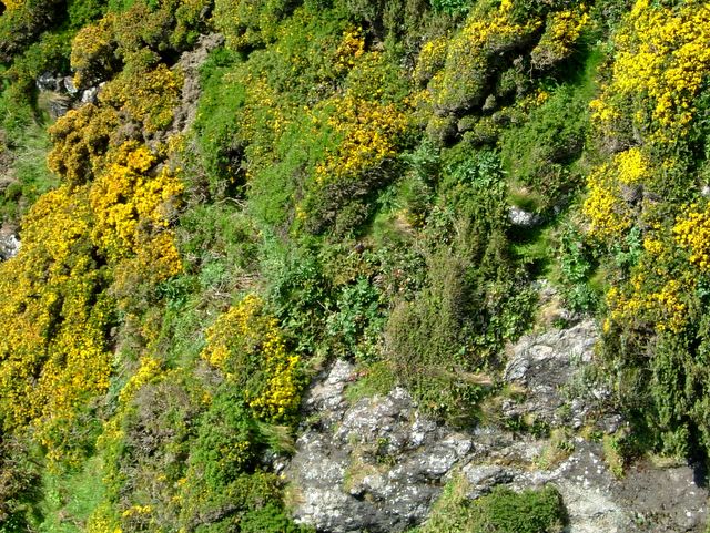
This yellow hilside was taken just up around Cape Perpetua this weekend, the flowers know its spring.
Leslie
Sand Blasted

Ughhh... The sun finally came back out; unfortunately the wind came with it. So far we had unseasonably warm and dry weather over the winter, we have now had cold wet weather since spring finally arrived. Then the sun comes out, and we're having summer wind in April! Its currently blowing 25.8 mph, the sand is whipping down the beach about a foot off the ground, can you say sand blasted? On Sunday, I was up on highway 101, and got a whole shot of the beach, that includes Baker and Heceta beach for those of you not familiar with our part of the coastline.
Leslie
Thursday, April 14, 2005
Large Yellow Orb

The sun finally came out yesterday afternoon.. We had an amazing sunset, and today it was nice all day. A bit on the cool side, but who cares, the sun was shining. I just checked the 7 day forecast and it's looking promising, we may finally get a break. However it is supposed to rain all weekend.

Wednesday, April 13, 2005
Dried Jelly Fish ?
The Jelly fish are starting to dry up... which is a good thing, when they're laying all over the beach wet, the smell gets to be ..... well quite beachy!
Friday, April 08, 2005
Jelly Fish in Abundance
It's that time of year again, when we get spring storms and the Jelly fish start washing up in droves. Supposedly this is the time of year to look for Japanese glass floats.....and several years ago that worked for me. I found a small float, right in the tide line floating among the jelly fish. That particular year, they washed up about 4 inches thick, as we had some very windy storms and rough seas. According to at least one book I've read, the same wind that blows up this particular Jelly fish also breaks the floats loose from the current pattern they're trapped in. - By-the-wind-sailor Velella velella
These jellyfish live in the open sea but are commonly stranded on local beaches after storms.
They are under four inches long and are a distinctive deep blue. They possess a float with small blue tentacles on the underside, used to catch their prey.
To aid transportation they have a transparent sail, which can be either left or right handed. Winds tend to distribute them into groups comprised of the same handedness, so strandings tend to be made up of one group.

Sunday, April 03, 2005
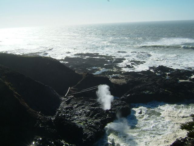
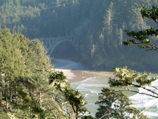
Cape Perpetua
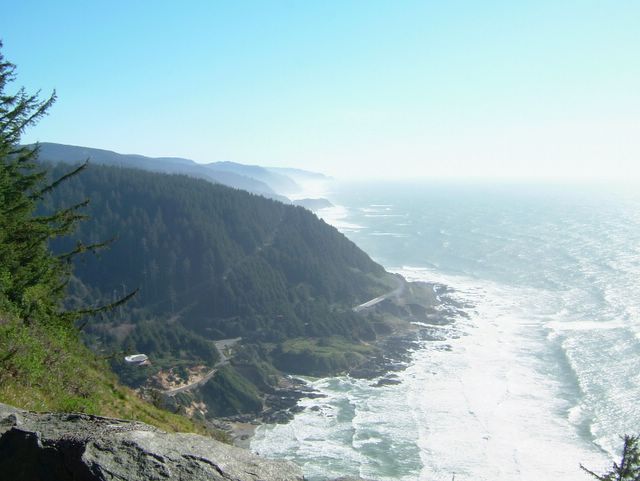
Cape Perpetua Overlook
All of these Cape Perpetua pictures were taken on March 12th, one of our last sunny weekends. Just a fantastic day... Almost 70 degrees, looks like we may already have had our summer......... :-(
1968 Ford Ltd. Wagon

1968 Ford Wagon Heceta Head Light House
WellI prefer to travel the coast in vintage style, if it's not in my 1967 Imperial Sedan, then it's my 1968 Wagon. Instead of those same old shots of the lighthouse, you then have something visually interesting to shoot in the foreground :-)
Coast Guard
Whoops, I forgot to mention that the Coast Guard was out circling in front of the house for a couple of hours today. They do go out and practice sometimes, but this didn't look like the usual practice session. As they circled up and down the beach, in a very organized pattern. I didn't ever see them find anything, and I did see two Coast Guard Cutters as well going North and South in the Ocean... Another Beach Mystery, but as it wasn't pouring I did go snap a few pictures.....


I like that last shot, where the kite appears to be chasing the helicopter and about the same size. Well if I hear what happened I'll post it here.
I like that last shot, where the kite appears to be chasing the helicopter and about the same size. Well if I hear what happened I'll post it here.
Still Raining.......
I know it's Oregon, but I was enjoying the unseasonable dryness. Now it's been raining for two weeks straight.. Oh well it makes for interesting sunsets and good photo's .
A dead sea lion washed up last week, it's quite ripe now. However it's attracting lots of Bald Eagles, so there's always a plus side. I'm hoping I'll finally get a decent photo of a Bald Eagle.
My past photos of un-recognizeable birds have been less than pleasing.


A dead sea lion washed up last week, it's quite ripe now. However it's attracting lots of Bald Eagles, so there's always a plus side. I'm hoping I'll finally get a decent photo of a Bald Eagle.
My past photos of un-recognizeable birds have been less than pleasing.
Subscribe to:
Posts (Atom)